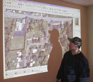
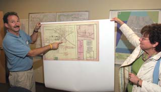
Computer-based mapping innovations took center stage last week in Ogden. An open house at the Ogden Highway Facility November 16 included giveaways, map demonstrations, digital aerial photography, GIS projects and more than 6,930 pictures of local buildings. A GIS is a computer-based mapping tool that takes information from a database about a location, such as streets, buildings, water features, and terrain and turns it into visual layers. The ability to see geographic features on a map gives users a better understanding of a particular location, enabling planners, analysts and others to make informed decisions about their communities. GIS is used throughout the world to solve problems related to the environment, health care, land use, business efficiency, education and public safety. The power supply directed to homes, the patrol cars, fire trucks and ambulances that keep neighborhoods safe and the delivery trucks function more efficiently because of GIS. This technology can also help businesses place ATMs and restaurants at more convenient locations, allow people to pull maps off the internet and help farmers grow more crops with less chemicals. Most recently GIS technology has been used to aid Homeland Security initiatives, map the debris field following the Space Shuttle Columbia tragedy, and monitor the spread of Severe Acute Respiratory Syndrome (SARS). For information go to http://www.ogdenny.com/OgdenGis.htm. November 20, 2005 |