Lake Ontario levels peaked early this year at 247.38 feet on May 5, four inches below the general flood stage, and over 20 inches lower than the peak in 2019. Lake levels are expected to continue their seasonal decline through summer and had fallen two inches from the crest through May 29.
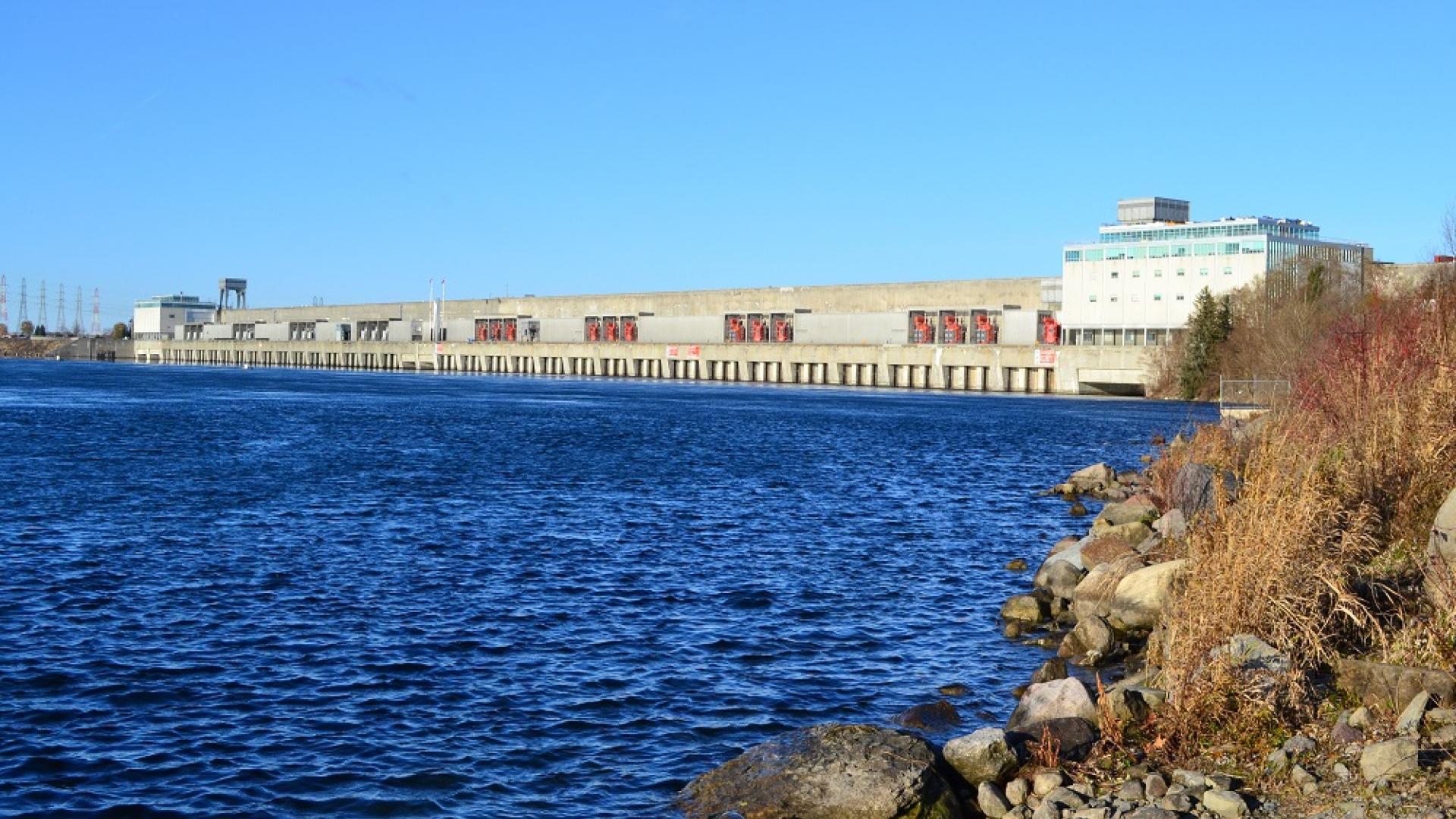
Lower Lake Ontario levels and the continuing high outflows are causing increased currents in the upper St. Lawrence River and also extremely low levels on Lake St. Lawrence, the forebay just upstream of the Moses-Saunders Power Dam. The International Lake Ontario – St. Lawrence River Board has assessed the situation carefully and, if necessary, will act to augment low levels at this location over the coming weeks.
The board’s extended general deviation authority (as granted by the International Joint Commission (IJC) on October 9, 2019) has ended. The board is no longer deviating by releasing outflows above Plan 2014 prescribed flows since Lake Ontario reached its peak and began its seasonal decline. The peak level of Lake Ontario is still well above average but was reduced by seven inches owing to deviations from Plan 2014. These deviation totals accumulated over the past several months as the board attempted to remove as much water as possible from Lake Ontario, before spring.
Drier conditions have prevailed in recent weeks, including around Lake Ontario and in the Ottawa and lower St. Lawrence River basins. These are the primary reasons for the recent decline in Lake Ontario levels, which has occurred despite very high inflows from the extremely high upper Great Lakes. These high inflows will continue for the foreseeable future, and, in response, Plan 2014 will continue to prescribe very high outflows, which will enhance Lake Ontario’s seasonal decline.
However, the lower and declining levels on Lake Ontario combined with the high outflows through the Moses-Saunders Power Dam that will continue are resulting in very low levels on Lake St. Lawrence that are anticipated to persist for months to come. This will be the fourth straight summer of well-below-average levels of Lake St. Lawrence, which responds much more rapidly and significantly to increases in outflows than the much larger Lake Ontario upstream. Had the board not deviated and removed water from Lake Ontario since last spring, Lake St. Lawrence would currently be approximately six inches higher.
On a May 22 teleconference, the board agreed to tap into the accumulated water removed from Lake Ontario, if needed, to maintain levels on Lake St. Lawrence above 239.50 feet (16 inches above the usual navigation-season low limit) until after the September 7 long weekend. As the board returns to plan flows, Lake St. Lawrence is expected to remain above this threshold for several weeks unless winds cause it to temporarily fall below.
Maintaining Lake St. Lawrence levels above 239.5 feet under actual conditions wetter than normal will require no flow reductions, which might cause higher Lake Ontario levels. This would have no impact on levels heading into 2021 under such wet conditions, and the board emphasizes that lake level and other conditions at the end of 2020 are poor indicators of what levels will be like in 2021. The primary factors are what Lake Erie inflows and Lake Ontario – St. Lawrence River basin snowmelt, runoff, and precipitation conditions are experienced next spring.
Augmenting Lake St. Lawrence levels may occur if very dry conditions result in lower Lake Ontario levels. At most, this would result in Lake Ontario levels up to 3.2 inches higher by September 7 than what they would be without this strategy, but only under the very driest water supply scenarios where Lake Ontario is much lower on its own. Most scenarios result in much smaller differences. Differences will be further reduced through the fall, such that, by the end of 2020, there is expected to be almost no difference in levels throughout the Lake Ontario – St. Lawrence River System.
The GLAM Committee continues to host an online questionnaire to allow shoreline businesses and property owners to directly report on impacts related to recent high water conditions that can be incorporated into the expedited review effort. The 2020 version of the questionnaire is now available at https://ijc.org/glam/questionnaire.
Information on hydrologic conditions, water levels, and outflows, including graphics and photos, are available on the board’s website and posted to the Board’s Facebook page, and more detailed information is available at https://www.ijc.org/en/loslrb.
Provided information